India Votes in Favour of UN World Map Resolution Promoting Equal-Area Projections
NEW DELHI: In a significant diplomatic move, India has voted in favour of a United Nations General Assembly resolution that promotes the wider use of equal-area world map projections. The Ministry of External Affairs (MEA) on Sunday clarified India’s position, emphasising that the resolution does not endorse any particular map and that India’s sovereign territory must always be shown according to its official map.
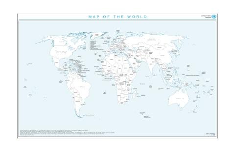
The resolution, titled “Correct the Map: Rebalancing Global Cartographic Representation and Promoting Equitable Representation of the World’s Regions, Particularly Africa,” was adopted on September 4 by an overwhelming margin of 164 votes in favour to one against. It encourages the adoption of equal-area projections that more accurately preserve the relative sizes of continental landmasses, addressing long-standing criticisms of traditional maps that visually distort the size of regions such as Africa.
India’s support for the UN world map initiative came with a clear explanation of vote. Indian diplomat Raghoo Puri stated that the resolution should be understood as supporting the broader use and consideration of equal-area map projections and not as endorsing the Equal Earth projection or any other specific map projection. The MEA further underlined that the measure neither adopts nor authenticates any particular world map and does not address political cartography, including international boundaries, disputed territories or place names.
At the same time, India used the occasion to reiterate its firm stance on territorial integrity. “India’s sovereign territory, including the Union Territories of Jammu and Kashmir and Ladakh, must be depicted in accordance with India’s official map. Any inaccurate or misleading depiction is unacceptable. Our position on India’s sovereignty and territorial integrity is clear, consistent and non-negotiable,” the MEA statement said.
This dual approach — backing a technical cartographic reform while firmly protecting national cartographic claims — reflects India’s careful balancing of global multilateral engagement with core sovereignty concerns. Equal-area projections aim to correct visual biases present in widely used maps such as the Mercator projection, which enlarges landmasses closer to the poles and shrinks those near the equator. Proponents argue that such distortions have historically underrepresented Africa and other regions in public perception, education and policy discussions. The UN resolution seeks to promote more equitable visual representation without entering the politically sensitive domain of borders or disputed areas.
India’s clarification is particularly relevant because cartographic depictions of its territory have been a recurring point of sensitivity in international forums, textbooks, media and digital platforms. By explicitly linking its support for the UN world map resolution to the requirement that any map must follow India’s official boundaries, New Delhi has drawn a clear red line. The MEA’s statement leaves no ambiguity: technical improvements in projection methods are welcome, but they cannot become a vehicle for inaccurate portrayals of Indian territory.
The resolution’s focus on Africa is especially noteworthy. Many equal-area projections, including the Equal Earth projection often discussed in this context, give the African continent a visual weight closer to its actual land area. Supporters of the “Correct the Map” effort argue that traditional maps have contributed to a distorted global worldview. India, by voting in favour, has aligned itself with the broader principle of more accurate geographic representation while carefully distancing itself from any implication that a single projection or specific map is being officially adopted.
In practical terms, the resolution is non-binding and does not compel member states or organisations to change their official maps. It functions more as a normative encouragement for educational institutions, publishers, media houses and international organisations to consider equal-area alternatives. India’s explanation of vote reinforces this limited scope. The MEA stressed that the text should not be interpreted as endorsing any particular projection, thereby preserving flexibility for countries to choose the cartographic tools that best suit their needs while respecting political boundaries.
The vote count of 164 to one indicates broad international consensus on the technical merits of equal-area representation. The solitary negative vote has not been publicly detailed in the available information, but the near-unanimous support suggests that most countries see value in addressing long-standing visual imbalances without opening contentious political debates over borders. India’s participation in this consensus, coupled with its precise reservations, positions the country as a constructive yet vigilant actor on the issue.
For Indian audiences and observers of South Asian geopolitics, the MEA’s emphasis on Jammu and Kashmir and Ladakh carries particular weight. These Union Territories remain central to India’s official cartography, and any international map that omits or alters their depiction is routinely rejected by New Delhi. By attaching this reminder to its vote on the UN world map resolution, India has signalled that support for progressive cartographic practices does not dilute its non-negotiable stance on territorial integrity.
Looking ahead, the practical impact of the resolution will depend on how widely equal-area projections are adopted by map makers, educators and digital platforms. Google Maps, school atlases, news graphics and United Nations documents themselves may gradually incorporate more equal-area options. India’s position ensures that any such shift must still respect the official Indian map when depicting the country’s boundaries.
In summary, India’s vote in favour of the UN General Assembly resolution on equal-area world map projections represents a measured endorsement of improved geographic representation. The MEA has made it clear that this support does not extend to any specific map or projection and that India’s sovereign territory, including Jammu and Kashmir and Ladakh, must continue to be shown accurately. The 164-1 adoption of the “Correct the Map” resolution marks a notable step toward more balanced global cartography, while India’s explanation of vote safeguards its core interests.
This development underscores the intersection of technical cartography and high politics. While the resolution carefully avoids political cartography, India’s intervention demonstrates how even ostensibly technical issues at the United Nations can become platforms for reaffirming fundamental principles of sovereignty and territorial integrity. As discussions around map projections continue, New Delhi’s dual message — open to reform, firm on borders — is likely to remain the guiding framework for India’s engagement with the UN world map agenda.